West Sedgemoor 2022
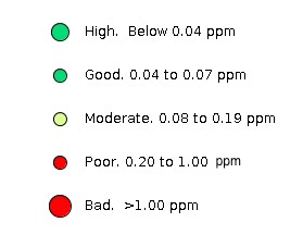
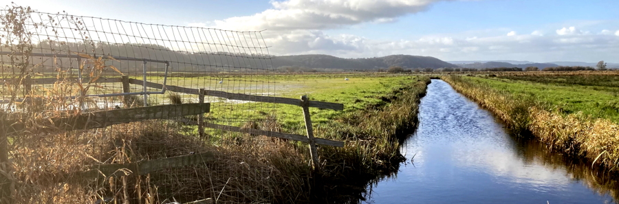 Looking upsteam in West Sedgemoor with the wooded higher land on the left. The water table is maintained high at this point which is an RSPB reserve. Phosphate 1.96 ppm (Feb22), over twice as high as the river Parrett
Home - 2022 Data - West Sedgemoor
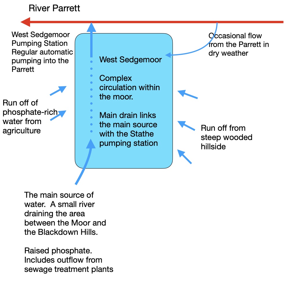
West Sedgemoor This is a page devoted to a 2022 phosphate survey of West Sedgemoor, the SSSI and Ramsar wetland around a Parrett tributary bringing water from as far as the Blackdown Hills in the south and joining the Parrett at the West Sedgemoor Pumping Station at Oath, downstream from Langport. West Sedgemoor SSSI is a particularly habitat for water birds and the RSPB have taken over and manage one section of it, maintaining, in the areas under their control, a water table that is significantly higher that that in the surrounding agricultural land. |
For a map of West Sedgemoor open the data point map here |
|---|---|
West Sedgemoor hydrology
|
|
The main source of water entering West Sedgemoor is a small river from the south west that drains a significant area as far as the Blackdown Hills. This flows directly into the Moor Main Drain flowing along the west side of the Moor to the West Sedemoor Pumping Station. A tilting weir diverts some of this inlet stream flow onto the Moor and this is set to divert a greater flow in summer (almost all the flow was diverted during the 2022 drought). Smaller quantities of water enter the Moor from higher land on the north west and south east sides. An additional water supply enters the Moor from the River Parrett through two manually operated sluices. These are significant in drier weather, preventing the Moor from drying out. One of these rhyns also brings water from the small moor south west of Langport. The overall amount of water entering the Moor from the river Parrett is relatively small under normal conditions but can be a significant source of phosphate in the moor as this remains whenthe water evaporates. Circulation of water on the moor itself is complex and seasonally variable; many rhynes flow in opposite directions according to season. A a higher water table is maintained in a part of the Moor owned by the RSPB than is maintained in the parts given over to agriculture. |
Some research and information papers on West Sedgemoor Professor Sean Comber and his team from the University of Plymouth have investigated the distribution of phosphate concentrations in sediment In West sedgemoor. This looks particularly at differences betwen sediment in the RSPB area and those under agriculture. Philip Brewin, ecologist with the Parrett Internal Drainage Board provides a detailed account of the complex hydrology and water management of the Moor. The maps associated with this report are here |
Phosphate in West Sedgemoor Follow the links on the right for mapping data for West Sedgemoor. More data are needed to identify clear emerging patterns but the following observations have been noted. 1 The flow rate of the water entering the Moor in the main stream from the south and the inlets from the Parrett seems to be comparable with the rate being pumped out into the Parrett under normal conditions. The phosphate concentrations in these inlets, the main drain, and in the water pumped out are broadly similar and less than that in the network of Moor rhynes suggests that the movement of water the length of the Moor in the main Drain is a significant flow pattern. 2 The phosphate concentration in the summer flow from the Parrett into the north east of the Moor seems to show a seasonal variation, starting the year low and gradually increasing. This is similar to the flow in Wetmoor and suggests removal of phosphate by growing plants early in the year. A decline may be expected in the autumn after the inlets are closed. 3 The concentration of phosphate in the Parrett and the Sowy is consistantly higher than the outflow of the West Sedgemoor pumps. 4 Significant differences in phosphate concentrations have been found between the higher pen water and lower pen water at the Hambridge Drove weir but these do not yet show any consistancy 5 Water from the Curry Wood side entering the moor in a stream along Hambridge Grove, shows a consistently low phosphate level
|
Data Map (Point data do not display in Safari) Map Legend
|
Data File A csv file of the data can be downloaded here. It can be viewed in Excel (last updated 23/10/22) |
|
Last modified |